


BRIEFING
BE PREPARED BEFORE YOU GO!

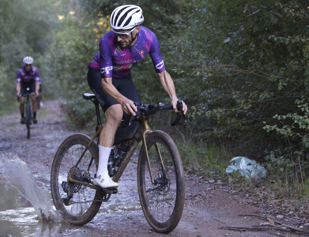
383 kilometers and 5,350 meters of vertical gain packed into two breathtaking stages: a raw adventure that starts and ends in the heart of Florence. Get ready for an epic test of endurance, where every single climb delivers pure adrenaline
The route at a glance
Two stages, 383 km and about 5,350 m of climbing, starting and finishing at the Società Canottieri Firenze with an overnight stop at PuntAla Camp & Resort. The highest point is 580 m at km 249, above Tatti.
Stage 1 · Saturday 26 September · start 7:00 am
Florence → PuntAla
Società Canottieri Firenze → PuntAla Camp & Resort
- 196.9km
- ≈ 2,600m of climbing
- 7KOM climbs
- 512 mhighest point
Stage 2 · Sunday 27 September · start 6:30 am
PuntAla → Florence
PuntAla Camp & Resort → Società Canottieri Firenze
- 186.2km
- ≈ 2,750m of climbing
- 10KOM climbs
- 580 mCima Coppi
Section by section
- km 0–40Florence → Signa → Montelupo → Montespertoli
Out along the Arno, then the first hills. Plenty of bars and water fountains.
- km 40–63Montespertoli → Castelfiorentino → Gambassi Terme
The first two KOM climbs. Closed barrier at km 51, messy woodland and a ford between km 59.6 and 60.2.
- km 63–110Gambassi → Molino d'Era → Montecatini Val di Cecina → Ponteginori
A ridge up to 512 m and a busy road at km 65. No water fountains for 38 km, between km 63 and 101.
- km 110–184Ponteginori → Querceto → Colline Metallifere → Montioni → Follonica
The hardest part: the Cat. 2 climb (km 115–123) and 65 km without a bar, with a single water fountain at km 163.5. Stock up in Querceto.
- km 184–197Follonica → PuntAla Camp & Resort
Along the coast to the Stage 1 finish: bike support, grocery store and restaurant.
- km 197–245PuntAla → Caldana → Giuncarico → Ribolla → Montemassi → Tatti
Back inland. At km 241, a hike-a-bike through the woods with a ford.
- km 245–301Tatti → Cima Coppi → Montalcinello → Palazzetto → San Galgano → Pievescola
30 km with no services between Tatti and Palazzetto, over the highest point of the route. At km 290, a 14% wall you will have to walk.
- km 301–383Pievescola → Colle di Val d'Elsa → Poggibonsi → Barberino → Mercatale → Impruneta → Florence
Last supermarket in Colle (km 323). Four short climbs near the end and a steep descent from Impruneta.
Tricky spots
- km 51.0Closed barrier
Climb over it or go around the side.
- km 59.6Messy woodland
At the bottom of a 9% descent: come in slowly.
- km 60.2Ford
Decide whether to ride through or walk.
- km 65.4Busy road
Follow the rules of the road and ride single file.
- km 241.0Hike-a-bike: messy woodland and ford
Walking section between Montemassi and Tatti.
- km 290.0Hike-a-bike up the 14% wall
Walking section before Pievescola.
Steepest descents (over 10% for 400 m): km 146, 181, 263, 268, 353 and 375.
Where to stock up
- 65 km without a bar
From Querceto (km 118.6) to Follonica (km 184). Only one water fountain, at km 163.5.
- 47 km after the last supermarket
From Colle di Val d'Elsa (km 323) to Impruneta (km 370) the route has only one water fountain, at km 348.9. In an emergency, a detour into Poggibonsi will find you something.
- 38 km without water fountains
From Gambassi (km 63) to Montecatini Val di Cecina (km 101). Halfway there is only the Molino d'Era restaurant.
- 30 km with no services
From Tatti (km 244.4) to Palazzetto (km 274.7), over the Cima Coppi.
Opening hours to know
- Saturday, km 110.6 · The Ponteginori bakery closes at noon.
- Saturday, km 196.9 · At PuntAla the restaurant closes at 10 pm; the grocery store is open 8 am–1 pm and 4:30–7 pm.
- Sunday, km 234.7 · The Ribolla bakery is closed: the bar and the water fountain are open.
- Sunday, km 244.2 · Il Barrino in Tatti opens at 8 am.
Approximate hours, from OpenStreetMap.
Download the track
Three versions of the same final route: a 383 km loop Florence–PuntAla–Florence. Pick the one that suits your device.
Track only
The route with no points of interest. Works on every bike computer, even the most basic.
- 3,488track points
- 0waypoints
- 296 KBfile size
Key points
The route with the 10 alerts that matter: barrier, messy woodland, ford, traffic, the two hike-a-bike sections and the four places to stock up.
- 3,488track points
- 10waypoints
- 298 KBfile size
Full
All 65 points: water fountains, bars, bakeries and alerts. Open it in an app such as OsmAnd or GPX Viewer, not on your bike computer.
- 3,488track points
- 65waypoints
- 314 KBfile size
- Load it via USB. Over Bluetooth the transfer can take several minutes.
- Too many waypoints can freeze some bike computers. If you see "no route information", use the Track only version.
- Komoot does not import waypoints. To see them, open the Full file in OsmAnd or GPX Viewer.
Route map
The climbs
Categories calculated as length × average gradient (Strava/UCI thresholds). Maximum gradient measured over 200 m. Profiles taken from the official GPX track.
Waypoints
| Km | Type | Name | Hours and notes | From previous | Map |
|---|
"From previous" is the distance from the previous point among those shown: filter "Water" only to see how far it is from one fountain to the next. Approximate hours from OpenStreetMap: check them before you set off.
TrailCore Radar
On both stages every rider must have the TrailCore Radar app installed and running. It is our safety net: it tells us where you are and lets us step in straight away if you are in trouble.
Download the app and turn tracking on before the start. You will receive the 4-digit race code on Thursday 24 September.
We know where you are
Your position shows up in real time on the organisers' map, along the whole route.
SOS button
If you are in trouble, hold it down for 3 seconds: it alerts the organisers and calls 112.
See the control car
You have the map too: the organisers' pickup following the group shows up as the control car.
How to set it up
- Download TrailCore Radar from the App Store or Google Play.
- Allow location access. Android: "Allow all the time" and "Use precise location". iPhone: "Always" and "Precise Location".
- Fill in your profile in the settings (⚙️): name and phone number are required.
- On Thursday, enter the race code under "Join an event" and switch on the green "Tracking Live (GPS)" toggle.
- During the stage turn the screen off and keep the phone in your pocket, but do not close the app. Start with a fully charged phone and a power bank.
Get the app
The guides
“Ranking”
No podium, just numbers. The Fiorino Mud is not a race: the ranking exists out of statistical curiosity, something to look at after the weekend and talk over with a beer.
-
Saturday · 7:00 am
Stage 1 start
Società Canottieri Firenze. The clock starts.
-
Stage 1 finish
QR scan at PuntAla
PuntAla Camp & Resort. The clock stops.
-
Overnight
Clock stopped
Dinner, shower, tent: the hours at the camp do not count.
-
Sunday · 6:30 am
Stage 2 start
From PuntAla. The clock starts again.
-
Final finish
QR scan in Florence
Società Canottieri Firenze. The clock stops for good.
The QR code is on the number plate that goes on your handlebar. Keep it visible and undamaged: without a scan at the finish, your clock does not stop.
The rules in short
-
No time limit
And no obligations beyond those in the rules.
-
Ride at your own pace
You set the pace, or the group you choose to ride with does.
-
Stop when you like
You can stop and stock up at bars and shops along the route.
-
It ends at the finish
Your ride ends when you pass the designated finish point.
Strava segments
Stage 1 has three Strava segments, listed in the order you ride them. Every rider with a Strava profile, free or premium, takes part. We will reveal the links to save them on Friday at the briefing.
Prize-giving on Saturday evening at PuntAla Camp & Resort, around 9:30–10 pm. Symbolic and light-hearted, just like the Fiorino Mud.
If you do not upload your activity to Strava, you will not be in the segment rankings. Times only appear once you have finished and uploaded the activity from your bike computer or smartwatch: upload it as soon as you reach PuntAla, before the prize-giving.
Live Segments
With a compatible bike computer or smartwatch (Garmin, Wahoo, Coros…) and a Strava subscription you can use Live Segments:
- an audio and visual alert at the start of the segment;
- the distance left to the end, in real time;
- your gap to the KOM/QOM as you ride.
To get them, the segments must be starred (⭐) on Strava and synced to your device: the links arrive on Friday at the briefing, in time to do it before the start.
After the Fiorino Mud
Want the whole adventure as a single activity? Merge the files from the two stages with GOTOES Merge GPS Files and upload the merged file to Strava.
Strava may reject it as a duplicate of the two stages: if so, delete the single-stage activities and upload the full one again. Your segment times stay, because they are in the full activity too. Do this after the prize-giving.









A two epic stage adventure discovering Tuscany to complete 400 km with 6900m elevation gain in a weekend of pure cycling challenge.
The Fiorino Mud 400 across Florence, Pisa, Siena, Livorno, and Grosseto.
Sponsor
Supporter


Media Partners